Content

Showing posts with label outdoors. Show all posts

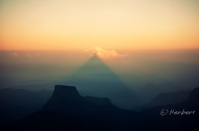
Location: Adam�s Peak�s shadow, Sri Lanka (6� 48' 41? N, 80� 29' 59? E)
Date: 3 March 1997; 6.15am

Camera: (analogue) Minolta compact with negatives and scanned

Adam�s Peak is the 4th highest peak in Sri Lanka. It is revered as a holy site by Buddhists, Hindus, Muslims and Christians. It has a 1.8m rock formation at the summit that resembles a footprint- the Buddhists regard that to be the footprint of Buddha, the (Hindu) Brahmans as that of Lord Shiva, the Muslims as that of Adam and the Portuguese Christians have conflicting claims that it is the footprint of St Thomas and the eunuch of Candace, the queen of Ethiopia. As such it is a popular and important pilgrim site. There are several routes to the mountain, involving walking up thousands of steps. Pilgrims normally starts very early in the morning so that they can be at the summit at sunrise to see the distinctive shape of the mountain casting a triangular shadow on the surrounding plain which can be seen to move quickly downward as the sun rises. In fact the walk up the summit during the wee hours of the morning itself can be quite a sight with the zigzag path leading up to the summit lit up by the lights of pilgrims.

Technorati Tags: ,
Read more »

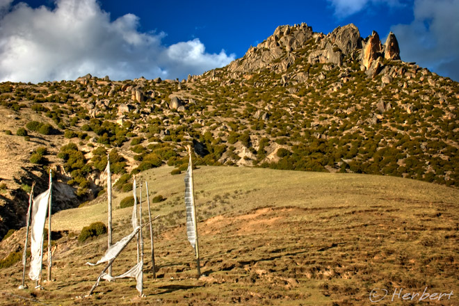
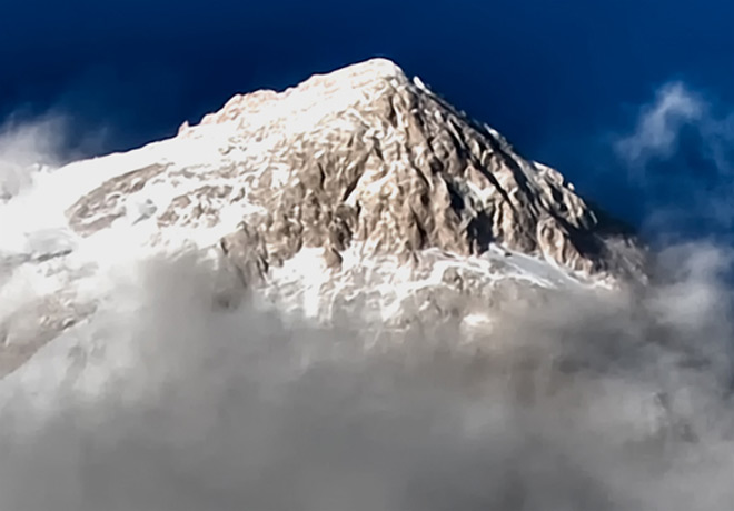
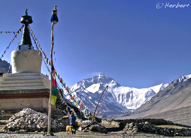
Location: Rhongbuk Monastery (5,100m), Tibet, China (28.194N, 86.829E)
Date : 27 April 2003; 10.25am
Camera : Canon G1

I always wanted to go back to see Mount Everest, either the Nepali or Tibetan (Chinese) side. Going to the Base Camp from the Chinese side has become much more easier in terms of transportation and access, but the problem now is in fact access to Tibet. I just applied for a visa to visit China and to my horror, instead of just one page of form to complete, I have to fill 7 pages now!! And unlike in the past, this must be accompanied by airline bookings (this was introduced just before the Olympics but was never taken off since). Travelling into Tibet is now ever more strict. Chances of getting in without a TTP and getting away is rather difficult as there are now numerous checkpoints and the guards are more vigilant. Perhaps I should try the cycling option next time- I think they are less likely to check cyclists- as long as one dressed more Chinese-like, and of course, have to look Chinese.

Read more »

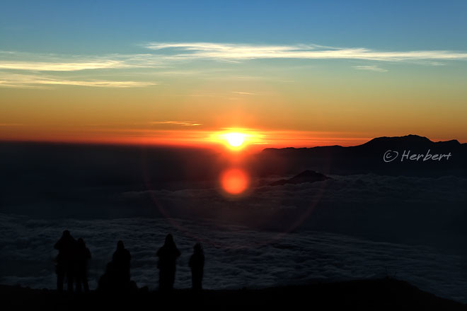
Location: At the summit of Mount Semeru, Indonesia (7�59'7.19"S 112�59'9.64"E)
Date: 18 July 2008; 6.15am
Camera: Canon 400D with Sigma 17-70/f2.8-4.5

One of the reasons people trek up to mountains is to enjoy the fabulous scenery and amazing sunset or sunrise. Mount Semeru is one of those places, as it is the highest mountain in Java. The sunrise at the top the peak is stupendous as one is virtually above the cloud covers. Often, depending on the direction of the sun, one can see his/her own shadow being casts on the clouds floating below them. Of course, one of the added excitement to trek up to the peak of Mount Semeru is the challenge (not easy to climb a volcano due to the deep ashes) and the adventure of standing beside a constantly-erupting active volcano. In fact lately it has been so actively erupting that the relevant authorities has banned any trekking to its summit.

Read more »

Locations: Rupuchaka Hot Springs, Sichuan, China (28� 46' 0? N, 100� 19' 0? E)
Date: 2 June 2004; 5.30pm
Camera: Canon 300D with kit lens

This Hot Springs is a few km from Daocheng, which is the gateway to the Yading Reserve. Yading Reserve is a major Tibetan pilgrimage site with 3 mountains considered sacred by Tibetan Buddhists. The Reserve has many snow-peak mountains and alpine lakes and is especially pretty in autumn. Like most beauty spots in China which are converted to Reserve, the whole process is messy. After the pasture has been converted to a Reserve, the activities of the people who lives there are heavily curtailed; but compensation was agreed based on a small % of the door intake. However apparently nothing was paid out and there were racial tension (the Reserve operators is a well-connected Han company while the Reserve and surrounding area is predominantly Tibetan) resulting in a couple of deaths. As a result the Reserve was closed to the public for a few years as the security establishment sort things out (which is normally not a pleasant thing in China). It has now been reopened for a couple of years. However with the recent deadly protests across Tibetan areas and the current protests at Kirti Monastery (which resulted in Tibetan deaths), Yading Reserve might be closed to foreigners soon as China customarily applies sledgehammer approach to balcking out of information about domestic problems.

Read more »

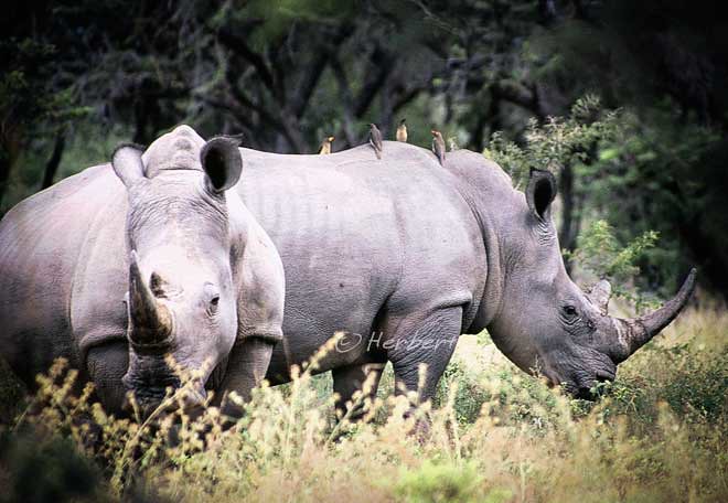
Location: Matobo national Park, Zimbabwe, Africa (20� 33' 0? S, 28� 30' 28.8? E)
Date: 29 April 2001; 4.15pm
Camera: (analogue) Canon 500N with slides and scanned

Rhinoceros poaching has reached an all-time high. In 2010, 333 rhinos were slain by poachers for their valuable horns, compared to 122 in 2009. Poaching is driven mainly by the demand of the rhino horns in Asia for its perceived medicinal properties. However extensive research and analysis have established that the horns do not contain any medicinal or aphrodisiac effects. One would appreciate the attractiveness of poaching when today weight-for-weight, rhino horn is more valuable than gold. Most of the rhinos poached are white rhinos- which are considered a near-threatened species- but a few endangered black rhinos were also slain. Stopping the poaching has become more difficult as poachers employ high-tech methods such as helicopters, prescription tranquillizers, night-vision goggles and high-powered rifles. Conservationists and game park owners have sometimes resorted to extreme measures to protect the rhinos such as poisoning the rhino horns with cyanide. Anyone consuming a poisoned horn will be poisoned by the cyanide.

Read more »

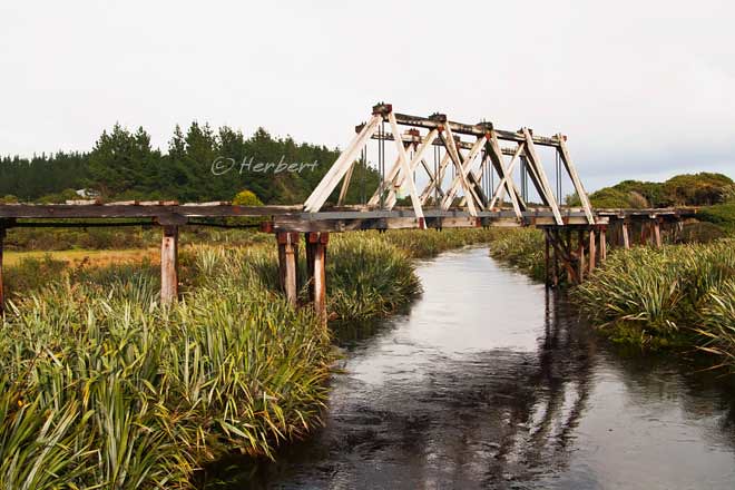
Location: Bruce bay, South Island, New Zealand (43� 36' 0? S, 169� 34' 0? E)
Date: 12 May 2009, 2.15pm
Camera: Canon 400D with Sigma 17-70/f2.8-4.5

Bruce bay is a windswept bay in the West Coast of the South Island. Here one can enjoy a sweeping coastal view of the Tasman Sea thrashing against the coast line. The coast is lined by elegant Rimu trees while the beach is largely deserted except for stones and driftwood. However it is rather spectacular in its sparseness and wild grandeur. The settlement here is old and was established mainly as a result of a Gold Rush in the 1860�s. Hence one can still see some old structures and elegant bridges still standing.

Read more »

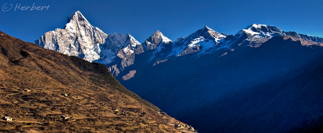
Location: Siguniang Shan, Sichuan, China (30�59'59.57"N 102�51'4.85"E)
Date: 29 October 2006, 4.40pm
Camera: Canon 300D with kit lens

Siguniang Shan means the �4 Sisters Mountains�. It is located in the Aba Tibetan Autonomous Prefecture in Sichuan, the same prefecture of the famed Jiuzhaighou Scenic Reserve. Siguniang is a Nature Reserve as well and is managed by the same company that has managed Jiuzhaighou. Hence the protocol of visiting this place is similar to Jiuzhaighou- one pays for entrance fee and a fee for the hop-on-hop-off bus service within the Reserve. There are three valleys within the reserve and there is an entrance fee (separately) for each valley.

Siguniang is well-known for its snow peaks, valleys, forests, lakes and biology. It is a UNESCO Heritage Site together with the Wolong and Jiajin Mountains forming the Sichuan Giant Panda Sanctuaries. According to the legend of the local Tibetan people, millennia ago there was a mountain god named Balang who had four beautiful daughters. The youngest of them was the tallest and had the most graceful figure. A devil admired the girls and wanted to marry them. So the devil challenged Balang to a fight for the girls. The devil won the battle and killed Balang, so the girls fled but eventually died from cold weather. Their bodies became the Siguniang Mountains and their father became the Balang Mountain. The Siguniang Mountains stand graceful, shoulder by shoulder plunging their heads into the clouds, with glaciers wrapping around their shoulders and green forests around their waists. The youngest girl is the tallest at 6,250m above sea level.

Read more »

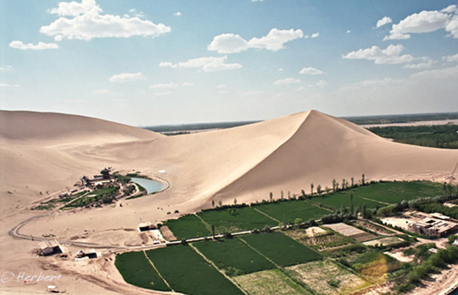
Locations: Mingsha, Gansu, China (40�5'18"N 94�40'33"E )
Date: 5 October 2008; 9.20pm
Camera: (analogue) Canon 500N with negatives and scanned

Dunhuang is one of the most interesting stops along the Silk Route of China. On top of its strong Hui (Muslim Chinese) traditions, it has history, thanks in no small part to the infamous tomb-raiding feats of a Aurel Stein, who nearly cut out all the murals of the Mogao Caves and shipped them back to Britain. Dunhuang also has the magnificent Mingsha Desert (Mingsha is so named for the sound of the singing sand, being wind whipping off the dunes). The sand dunes are situated at the edge of town and are fringed by green farmlands as seen above. Most visitors to Mingsha would probably not realised this as one has to climb up one of the higher sand dunes to have a panoramic view to appreciate the amazing nature of the landscape.

Technorati Tags: ,,
Read more »

Location: Twyfelfontein Rock Art, Namibia (20� 35' 26? S, 14� 22' 20? E)
Date: 18 April 2001; 2.15pm
Camera: (analogue) Canon 500N with slides and scanned

When someone mentioned Rock Art, invariably one would think of ancient paintings and engraving by people who lives thousands of years on rocks. Rock Art has been discovered all over the world- mostly by ethnic inhabitants of the place concerned. Hence there are Aborigine, Maori and plenty more in Europe, India, Central America and so on. One common theme of such Rock Arts is that they normally depict animals of the time or motifs and hand prints. Most of such sites that have been discovered around the world are now listed as UNESCO Heritage Sites. Twyfelfontein in Namibia is one of the most well-known Rock Art site in Africa. There are a few thousands of such rock engravings in Twyfelfontein, many of them in relatively good condition; no doubt helped by the dry weather condition in that area. Most of the engravings are chiseled into the sandstones and are depictions of animals such as lions, giraffes, buffalos, wildebeests and so on.

Technorati Tags: ,,
Read more »

Location: K2 summit from Concordia, Pakistan (35� 44' 0? N, 76� 31' 0? E)
Date: 9 July 2007; 75.30am
Camera: Canon 400D with EF 70-200/f4 IS L

My trek to the K2 Base Camp 3 years ago was not as tough as I expected. The altitude was high but was not as exhaustive as I can remember compared to the trek to Everest Base Camp. I guess one reason is that we had porters for the K2/Concordia Trek- which anyone trekking to Concordia must, because of the lack of villages and supplies on the way- whereas I did then Khumbu trek to Gokyo and EBC all on my own i.e. carrying my own pack, without any porter or guide. Furthermore trekking alone in Khumbu, I could walk as far or as long as I like- and tend to do further/longer most days- while in group trekking, the distance walked each day is not as demanding. Regardless it is always a sense of achievement reaching the Base Camps.

Technorati Tags: ,,
Read more »

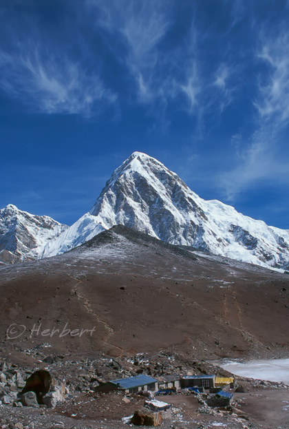
Location: GorakShep, Nepal (27� 59' 45? N, 86� 49' 42.3? E)
Date: 21 April 2000; 8.45am
Camera: Canon EOS 500N (analogue) on slides and scanned

Kala Pattar (meaning �black rock� in Hindi) is in fact a brown hump opposite the mighty giants of Everest, Lhotse and Nuptse in the Khumbu region of Nepal. It lies just below the south face of Pumori (7,165m). Kala Pattar is like a �must� for anyone who trek to the Everest Base Camp on the Nepali side; reason being the summit of Everest is not visible either from the base camp itself or from a lower base such as GorakShep. However the mountains are pretty spectacular from Kala Pattar- the best view is of course at the top. Most trekkers will first arrive at GorakShep � which are those huts in the picture- and ascend from the back of those huts. GorakShep itself WAS the original base camp during the days of Sir Edmund Hillary. It is now the last place any trekkers i.e. those without climbing permits, can stay overnight (not allowed to camp at Base Camp without climbing permits).

Read more »

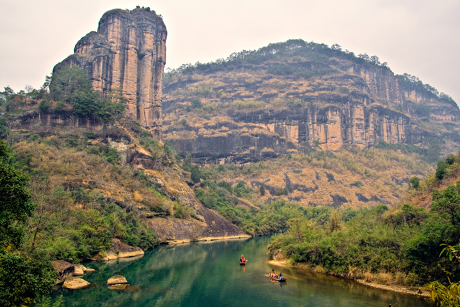
Location: WuyiShan, Fujian, China (27� 43' 0? N, 117� 41' 0? E)
Date: 5 December 2007, 9.15am
Camera: Canon 400D with Sigma 17-70/f2.8-4.5

China has just had 2 more entries into the UNESCO Heritage Sites List last week. It is fast catching up and very likely to have the most sites declared as UNESCO site soon- currently the highest number is Italy (45) followed by Spain (42) and China (40) according to the UNESCO Full List. I used to enjoy visiting such places in China as they are normally either places of extreme beauty or of tremendous cultural and historical significance (which is relevant to me as a Chinese). However in the last few years, I stop seeking them out as destinations of choice because I found that once a place became a UNESCO site in China, instead of being the peaceful and sublime places they used to be, they are marketed heavily domestically and regularly swamped by tourists. On top of that, invariably high entrance fees will be levied; this is fine if the collections go towards the site maintenance, but that is often not the case in China. What I find most abhorring is the commercial developments preceding some sites that are likely to be declared as a UNESCO Site; there have been reports that in some sites old dwellings were demolished and centuries-old livelihood destroyed to make way for spanky new commercial buildings in anticipation of the tourist traffic.

Read more »

Location: Arrowtown, South Island, New Zealand (44� 57' 0? S, 168� 50' 0? E)
Date: 24 May 2009, 3.10pm
Camera: Canon 400D with Sigma 17-70/f2.8-4.5

Arrowtown is an old gold mining town that has past its mining glory and more or less forgotten until about 20 years ago. Due to its proximity to the ever-popular Queenstown, it was discovered then, and since had become a favorite to package tour groups especially from Asia. The town is small and has some old buildings, which honestly are forgettable. The main street of old houses are refurbished and are now mainly shops selling souvenirs and so on. The only reason to go to Arrowtown is during autumn when the town is really beautiful with autumn glory. Otherwise don�t bother.

Read more »

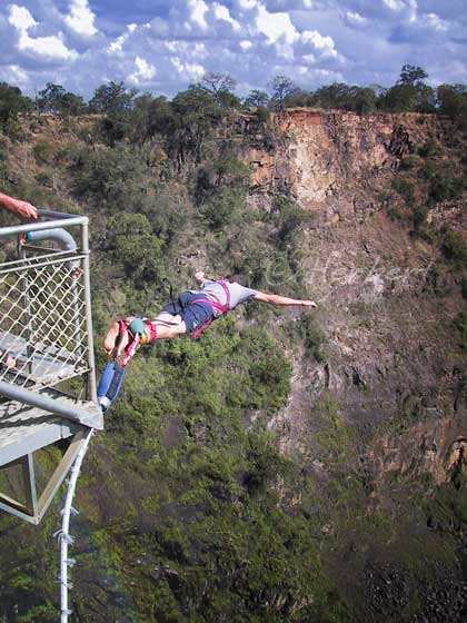
Location: Victoria Falls, Zimbabwe, Africa (17� 55' 28? S, 25� 51' 24? E)
Date: 5 April 2001; 4.20pm
Camera: (analogue) Canon 500N with slides and scanned

Bungy jumping had come a long way and is now such a common �adventure� activity that one sees such a set-up in most tourist spots that has a certain level of height such as rivers, lakes, bridges and buildings. It is quite an experience to jump off a bridge or whatever it may be. The moment of truth is actually when one stares out into the open space and height. It takes some courage for one to decide to leap. I have seen many people who wanted to try bungy jump to freeze when standing at the edge of the bungy platform and either have to be gently nudged or simply retreat to gather their courage for a jump at another time. In any case, bungy jumping is an experience that I would encourage. However if you do want to bungy, it is very important to do so with a reputed operator- it does not matter if it cost a little more- safety is of utmost importance.

Read more »

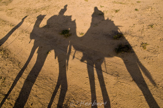
Location: Camels & riders, Jaisalmer, Rajasthan, India (26.92oN, 70.9oE)
Date: 30 Dec 2008; 3.30pm
Camera: Canon 400D with Sigma 17-70/f2.8-4.5

A good friend of mine who have been to the Namib Desert of Namibia was terribly upset and disappointed with �the so-called dessert and camel rides� in Rajasthan. I thought it was humorous for her to expect the Thar Desert to be anything remotely close to the great sandy dunes of Africa. I supposed if the Tourism people of India and Rajasthan did not make such a big deal out of the �desert experience� of Rajasthan, tourists� expectations will not be so high. Anyway I did not have high expectations when I did the so-called �camel safari� after hearing the feedback from my friend. So I was not disappointed. To me it was just a night out in the so-called desert.

Technorati Tags: ,,
Read more »

Locations: Feilaisi, Yunnan, China (28�29'44.27"N 98�54'9.21"E)
Date: 8 July 2004; 6.40am
Camera: Canon 300D with kit lens

Meili Xueshan is a subrange of the Hengduan Shan at the convergence of Tibet, Yunnan, Myanmar and Sichuan. The Meili range has more than 20 permanent snow peaks with at least 6 that are over 6,000m. Kawa Karpo (or Prince Peak) at 6,740m is the highest mountain of the range and in Yunnan. It is a holy mountain to the Tibetans- its importance is reinforced by the fact that of the 13 holy mountains, it is the only "male" mountain. Many Tibetans pilgrims come to circumambulate around the mountain on a 13-day kora- it will take us longer to do so. It is said that one has to be very lucky to even see Kawa Karpo as it is mostly shrouded in clouds. Many visitors to Yunnan venture as far as the so-called Shangri-la (old name Zhongdian) and go no further north. Whilst Shangri-la is a popular destination for many tourists as it was the place where most visitors would experience the Tibetan feel for the first time without going to Tibet ("was" because it no longer is due to Sino-isation of the town), it is really an unexciting place. Feilaisi is about 15 km outside another forgettable town, Deqin, which lies about 145km north of Shangri-la. This is where one should come to enjoy the mountain scenery in Yunnan, see the LancangJiang (Mekong River) and probably do some light trekking into the beautiful valley of Yubeng. Trust me- this is one journey that you will not regret going.


Read more »

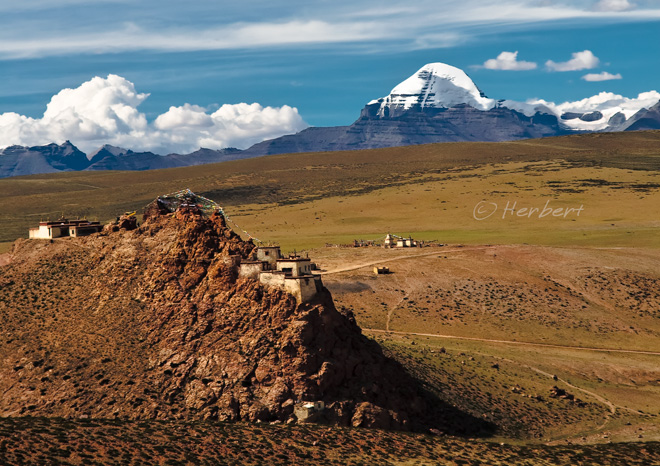
Location: Chiu Gompa & Mount Kailash, Ngari, Tibet, China (30�45'55"N 81�22'5"E)
Date: 8 August 2007, 4.20am
Camera: Canon 400D with Canon 70-200/f4L USM

There are a few gompas surrounding Lake Manasarovar the source of the mighty Indus River (incidentally the name �India� is derived from the river). The most well-known of these gompas is Chiu Gompa which is situated in Chiu Village. It is often used by as an overnight stopover by trekkers participating in packaged trekking groups. The gompa, sitting atop a craggy hill, enjoys a fabulous vantage point overlooking the lake while Mount Kailash is visible over the distance to the north. In fact the gompa has one of the best locations in this region to view the two major reasons to visit this remote part of Tibet.

Read more »

Location: Five Rivers, South Island, New Zealand (45� 37' 0S 168� 26' 60E)
Date: 18 May 2009, 2.15pm
Camera: Canon 400D with Sigma 17-70/f2.8-4.5

NZ is really a pretty place to visit. It has a wide variety of landscapes (ranging from beautiful serene beaches, wetland forests to volcanoes and alpine mountains) and weather conditions in a small landmass. Most of the country is still relatively wild and untouched by human. This is a result of both a conscious effort by the people of the country to preserve the land and its relative isolation. The sparse population is also a factor; well, sparse population of human anyway. According to the latest statistics, NZ�s human population is about 4.7 million but has 32 million of sheep and 5.8 million of cows. The sheep-to-human ratio used to be at a staggering number of 20 to 1; though it is still high in the South Island where the human population is lower but with more extensive sheep farming. Most visitors to NZ will spend their time in places such as Queenstown and Te Anau; however the least visited places are normally the most scenic, such as this small farming town in Otago.

Technorati Tags: ,
Read more »

Location: Dieng Playeau, Central Java, Indonesia (7� 12' 0? S, 109� 54' 0? E)
Date: 19 December 1995; 5.20pm

Camera: (analogue) Canon EOS 500N on negatives and scanned

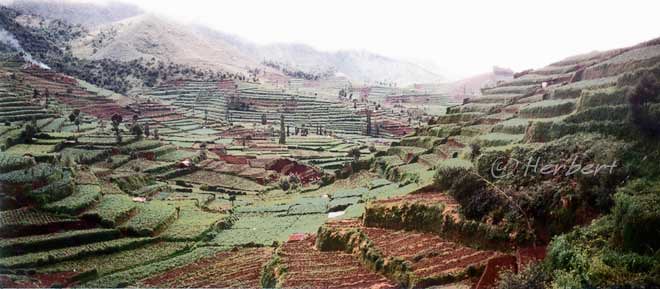
The Dieng Plateau is a plateau on the caldera floors of the Dieng Volcanic Complex in Central Java. The plateau is at a height of about 2,090m above sea level. It is well-known for its candhis, or Hindu temples, supposedly the earliest Hindu temples in Indonesia. This place is fresh as it is relatively high and can be quite chilly. It is often misty in the morning due to its height and the heat emitted from the volcanic ground around here. The journey up to this plateau is one of the prettiest in Java- all along there are small villages with layers and layers of rice and vegetables on terraces. Cultivation is plentiful in this region as the volcanic soil is extremely fertile. If you are making a visit to Central Java, to places such as Borobodur, Prambanan and Yogyakarta, it is worthwhile scheduling some time to visit this place.
Read more »

Location: Ghandruk on Annapurna Circuit, Nepal (28� 29' 24? N, 83� 50' 24? E)
Date: 14 April 2000; 4.45pm
Camera: Canon EOS 500N (analogue) on slides and scanned

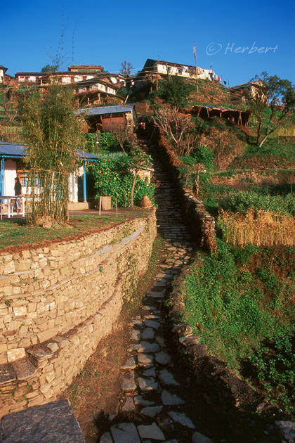
The Annapurna Circuit trek is one of the most popular trekking routes in Nepal. Every trekker who has done this circuit will know and probably remember this beautiful Gurung village in the shadows of the snowy peaks of the Annapurna and Machhapuchhere. At 2,012m it is inhabited by Gurungs, one of the many indigenous people of Nepal�s mountainous valleys. The Gurungs are more well-known overseas as they form a big bulk of the famous Gurkha soldiers, famed for their bravery and loyalty. Ghandruk is a quaint village with a very relaxed atmosphere and the major past-time (for most foreigners and trekkers anyway) is mountain-watching.

Technorati Tags: ,,
Read more »

About

Nothing happens when you sit at home. I always make it a point to carry a camera with me at all times…I just shoot at what interests me at that moment. – Elliott Erwitt"
“I treat the photograph as a work of great complexity in which you can find drama. Add to that a careful composition of landscapes, live photography, the right music and interviews with people, and it becomes a style.” – Ken Burns